Pacific Northwest via Monument Valley

This section is for people to post trip writeups and pictures AFTER the trip is over.

Moderator: Moderators

Post Reply
toolinalong
Double Lifer
Posts: 166
Joined: Wed Apr 26, 2006 9:09 am
Donating Member #: 0
Location: COLORADO

Pacific Northwest via Monument Valley

Post by toolinalong »

So this travelogue will be a while in the making. Like GypsyRR's beautiful epic, which most certainly has informed the layout of this one, it will be broken up into multiple days' postings. It takes a fair amount of time to get the photos ready for presentation. And the maps are taking a lot of time. And I am a slow, slow writer. This first day alone has taken me all day today. But hopefully you will find it entertaining on some level, and I will probably get faster at it. And like my friend Max likes to say about his work, if it ain't fun, why do it?

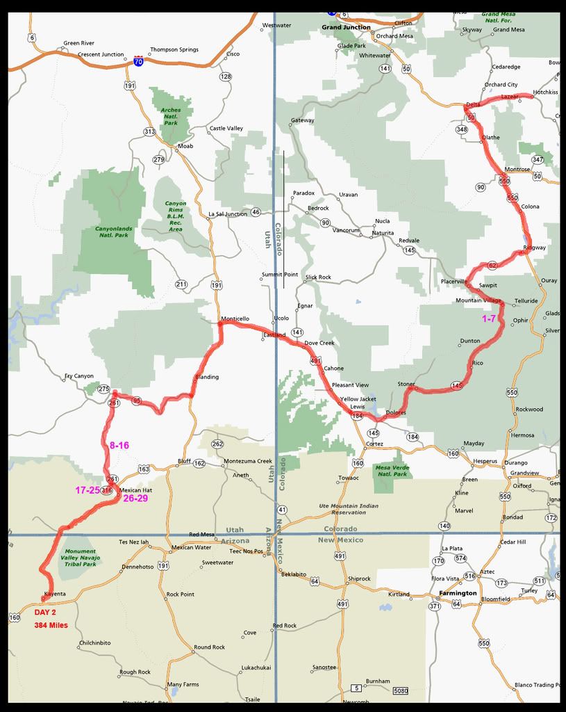
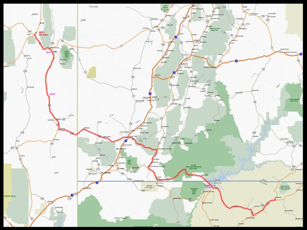
Regarding the maps, I am putting numbers on the route which correspond to where the pictures were taken at. Let me know if you think that it's worth the effort.

Some more information and a disclaimer here at the start:
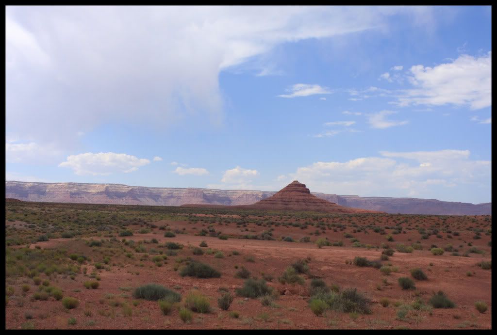
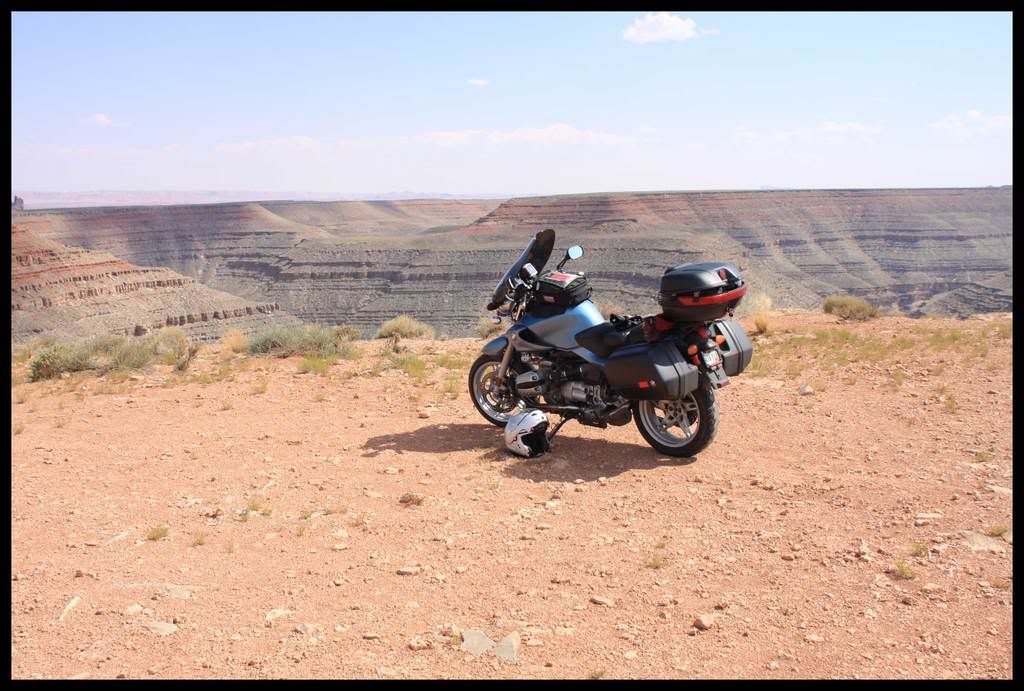
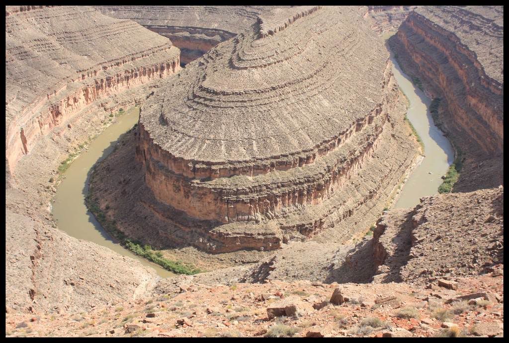
I consider myself an amateur, perhaps an advanced amateur, photographer, and a rider of compentent skill. Which means I am always looking to get better at both. I too have a tendency on my trips to not stop everytime I see a great landscape or roadside item that I would like to shoot. Sometimes it was because there just were not any pullouts, or the lack of shoulders made it too dangerous, and sometimes I just want to get into and/or on with the ride. I did however make a much greater effort on this trip to stop a lot, so the overall coverage of the routes is better then usual for me. But I still left some big holes in the routes photo-wise. So you will not see any photos of Monument Valley (you can find good ones of that place almost anywhere), and I did not, alas, stop for all of the truly great vistas in southern Utah, esp. the ones just outside of Blanding and Kanab. And there are other places missing as well. So there may be some days with very few photos, but I think there are a few here from most of the roads that were new to me, and some of the ones I have been on previously. Anyhow, I'll ride all these roads again someday and take more photos then.

Also, you will not see any animal shots this time. Not that I didn't see them, they were everywhere on the rural roads I tend to ride. Same with old buildings. I just did not stop and shoot them this time. I did shoot some pics of the outrageous wildflowers that lined the roads in the Cascade mountains in Oregon, but they tended to be the ones that did not come out so well, or I just failed to capture them well enough to show.

And then my camera's: I took two, a Canon A530 point and shoot which I kept in my tankbag for instant access. I also purchased a Canon D40 (it lived in the topcase) just before leaving, but I did not spend much time learning it's operation. I have owned a Canon A2E since the mid-90s, and we have a D60 at work, so I know them pretty well. But a lot of my photos came out with less then sharp focus. Sometimes that was cause I was too lazy to get off the bike and/or remove my helmet at pull-overs, and sometimes I am not sure why they were not sharp. Anyhow I may decide to post some of the less then sharp ones anyways. We'll see.

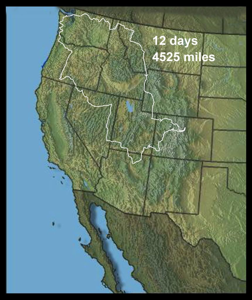
Here is the overview map which shows the entire route. I left on July 2nd, at about 10am, and arrived home on July 13th at about 8:30pm. No camping this trip, all motels.

Image

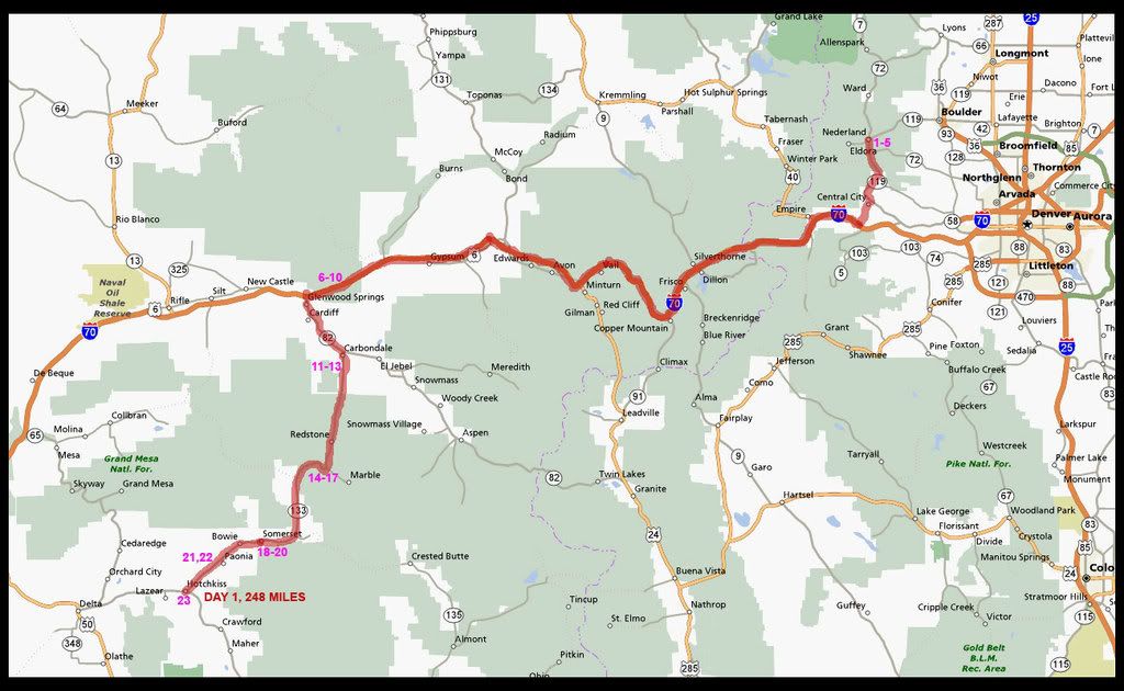
Here is the map of Day 1.

Image


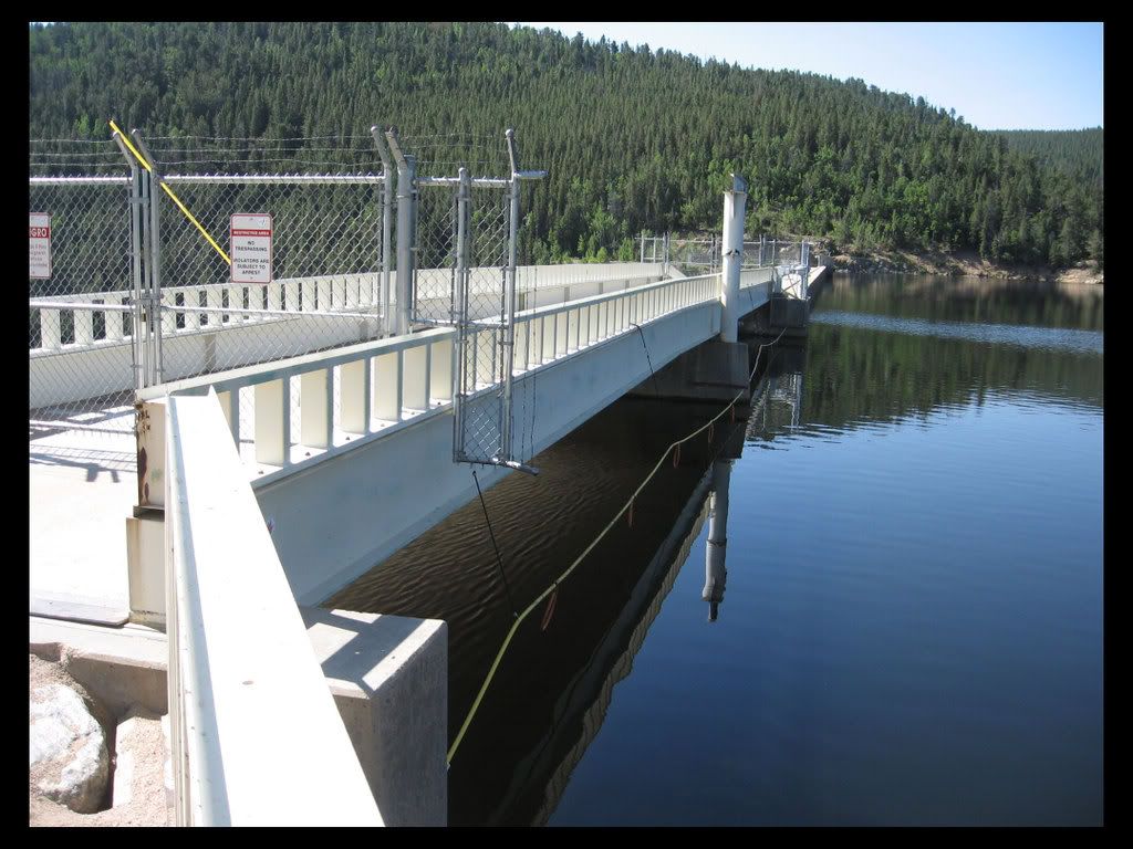
At the bottom of the hill from my house, 1 mile from home, I could not resist taking a few departing shots of the reservoir and dam:

The town of Nederland is at the west end of Barker Reservoir:
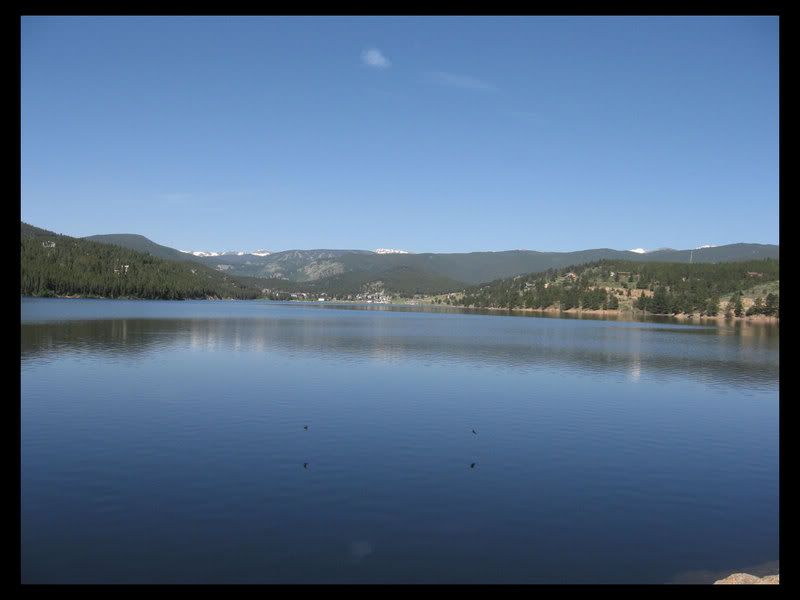
Image

The top of the dam:
Image

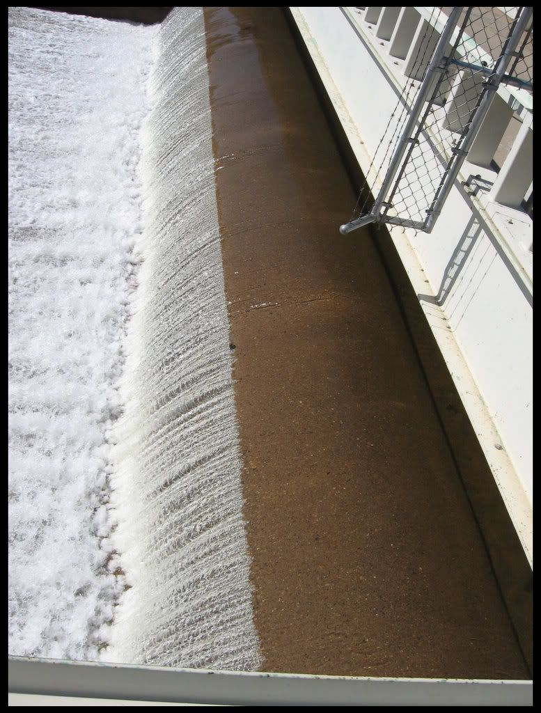
Water rushes over the top; this normally only happens for a few days each summer, when the run-off fills the reservoir. It was quite a bit later then usual this year, and is lasting a lot longer as well.
Image

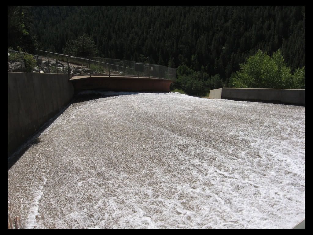
The Spillway. The dam is about 170 feet above the creek, and about 660 feet across. It was finished in 1910, and is one of the first ever to use pre-stressed concrete.
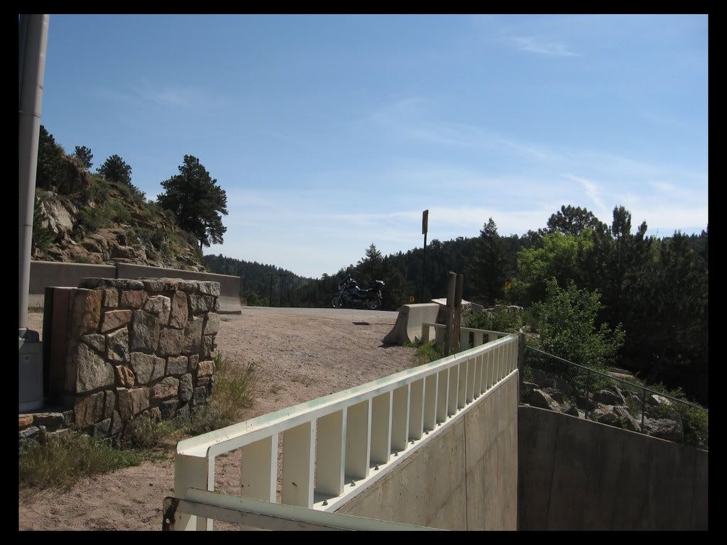
Image

OK. Time to leave.
Image

I did the first leg on I-70, cause I live here and have seen it all before a few times, and I knew what roads I wanted to ride while in Colorado; Highway 133 and Highway 145. So I was interested in getting over to the western slope pretty quickly. Unfortunately, I ran into 2 construction zones, and a heavy rain shower, so I only did 248 miles this day, instead of my planned 400 or so.

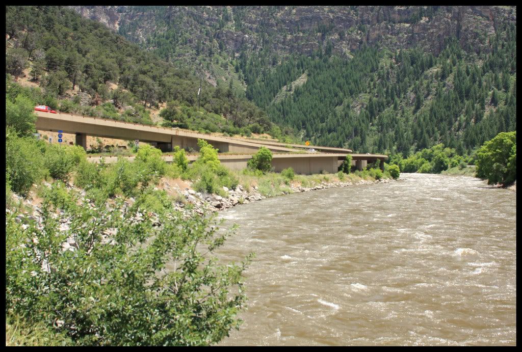
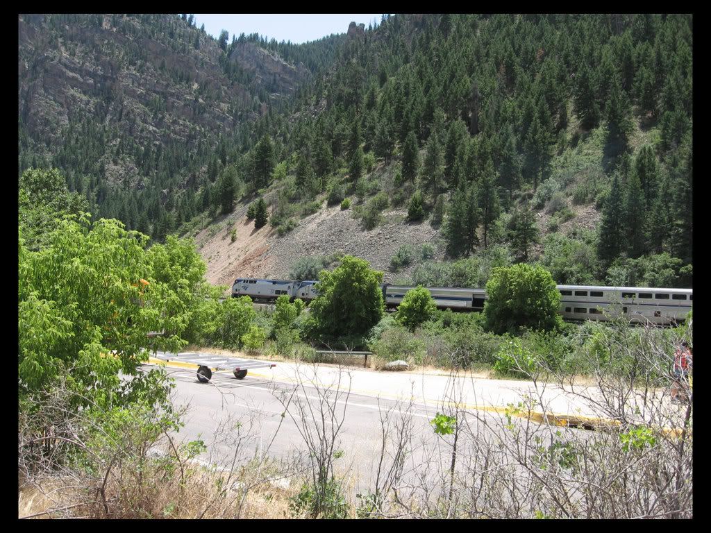
This first set of pictures are of the Colorado River, a couple hundred miles downstream of it's headwaters in Rocky Mountain National Park. It is fast and deep as it runs through it's first major canyon (Glenwood Canyon) on it's long journey to the Sea of Cortez. And the rail line on the bank opposite the highway is in constant use. It is the major railway thru Colorado to lands west, used by freight, coal, and AMTRAK trains.

Image

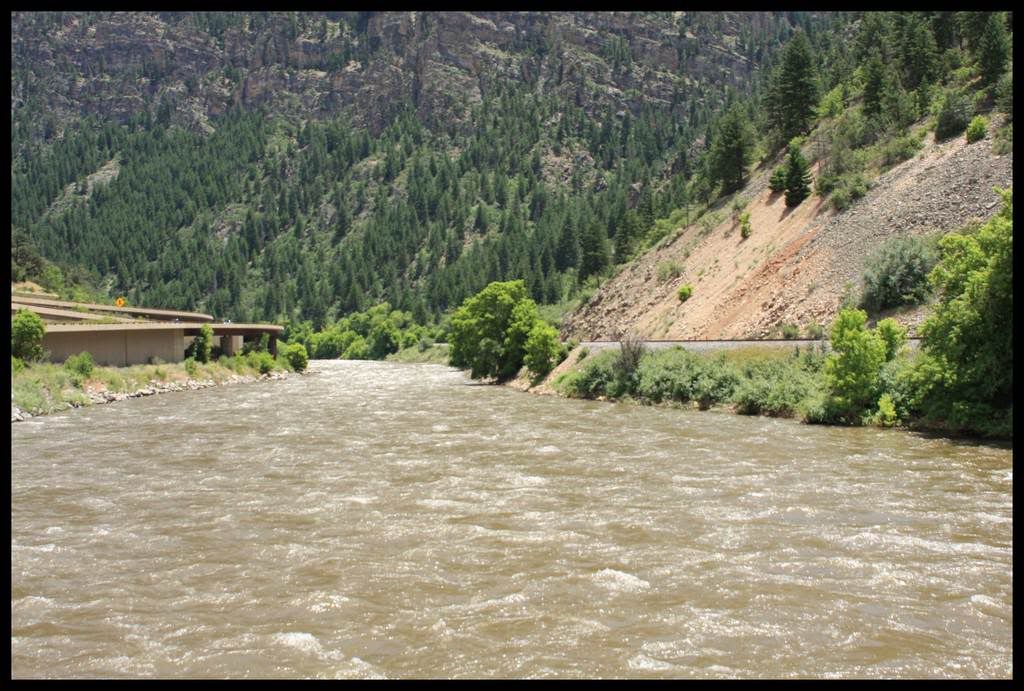
This is one of the last stretches of Interstate 70 to be completed. The construction of it was delayed for a long time by Colorado citizens who wished to spare this most beautiful canyon from the traffic. But in truth, the traffic was already there, it was just restricted to going 45 mph on the 2-lane blacktop, which was almost entirely just a few feet above the level of the river. I have been here long enough to remember many trips before, during, and after the construction. I think they did a pretty goood job of it, but people race through it now and rarely stop to admire it's beauty.

Image

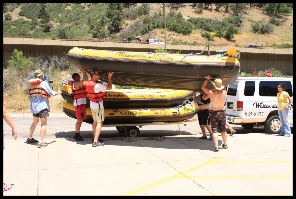
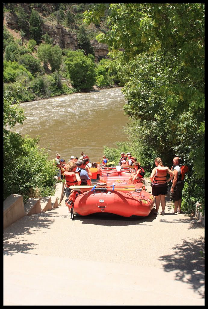
I stopped for a snack because I was tired from the 125 miles of interstate riding and waiting, and to shoot my first pictures. Just as I was about to leave these guys pulled up. This rest stop is about 16 miles from the city of Glenwood Springs. I asked someone what the deal was. They said it was a 3 hour round trip including the bus ride out and the rafting back.

Image

Image

I got all suited up again, and just as I started my motor, a train came by, so I hopped off the bike and got a couple of shots of the AMTRAK going by with the tankbag camera.

Image

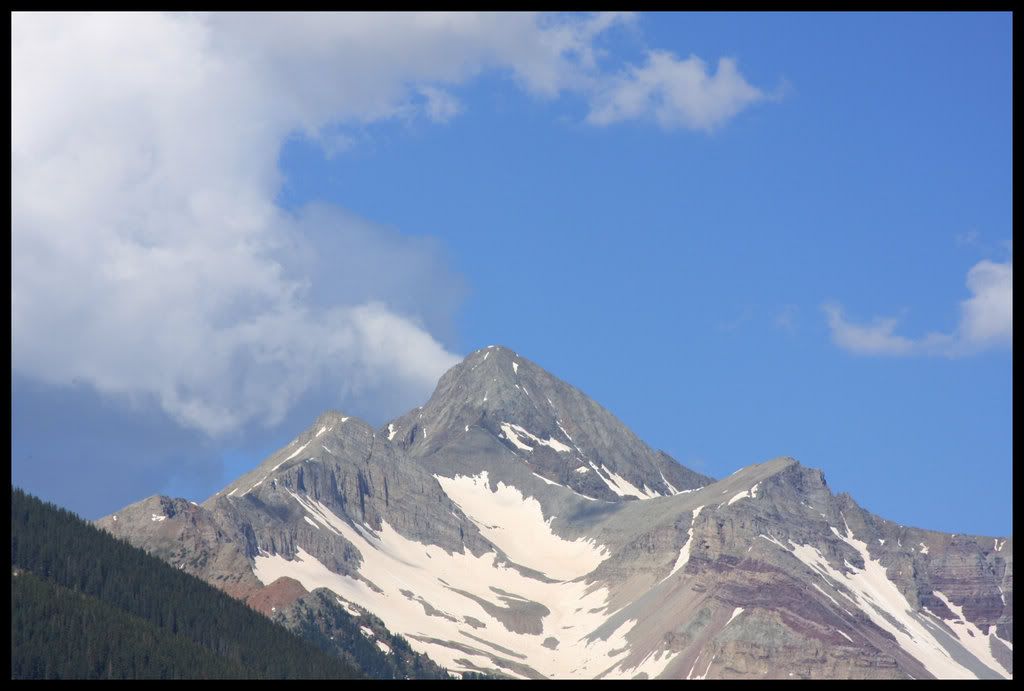
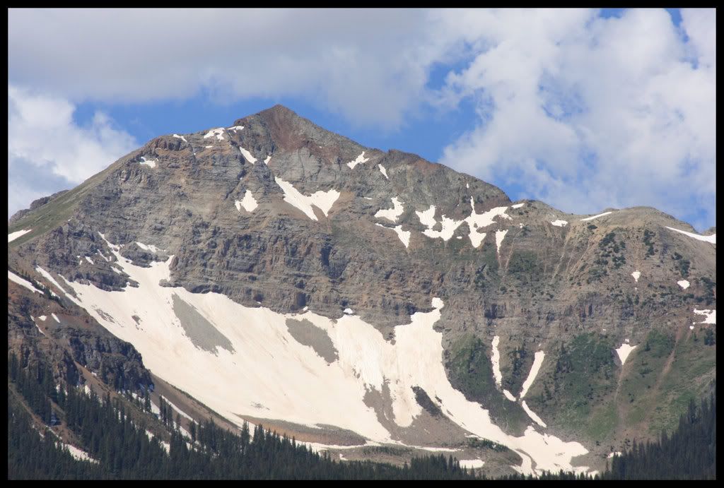
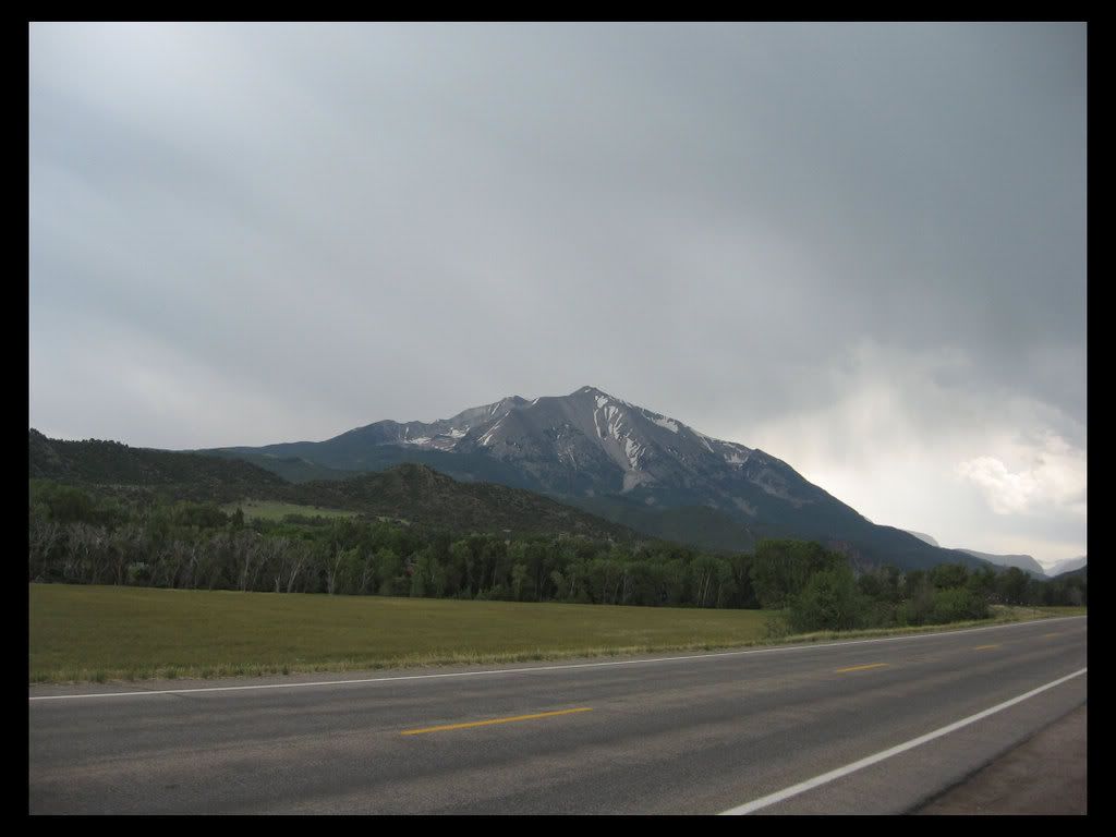
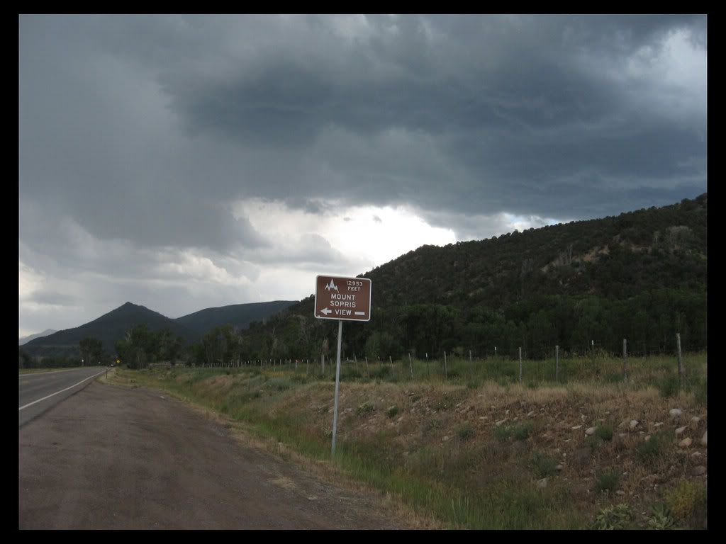
Mt. Sopris is a beautiful mountain with a lot of spirtual connotations for the residents of area. It sort of stands alone, and can be seen well from a lot of locations. These shots are on the start of Highway 133, just outside of Carbondale.

Image

Image

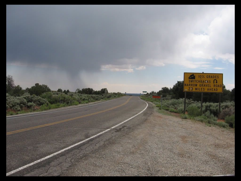
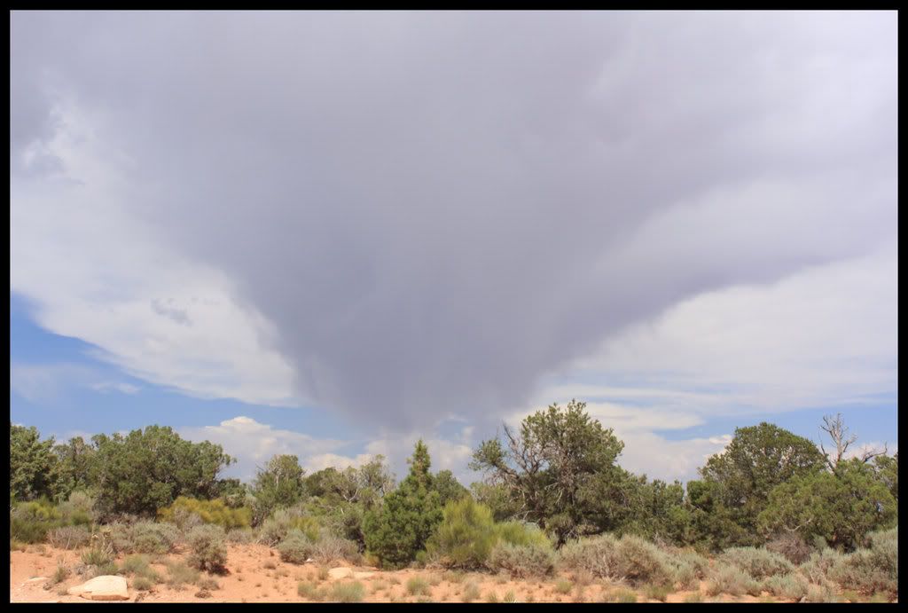
As you can see from this next picture, there was a rainstorm up ahead which is actually why I stopped here. I wanted to see which way it was moving. A lot of times around here if you just wait a few minutes you can avoid a storm. As I sat there checking it out, a fairly big bolt of lightning came down a couple of miles away. But I was about to enter a steep walled canyon, so I was not too concerned.

Image

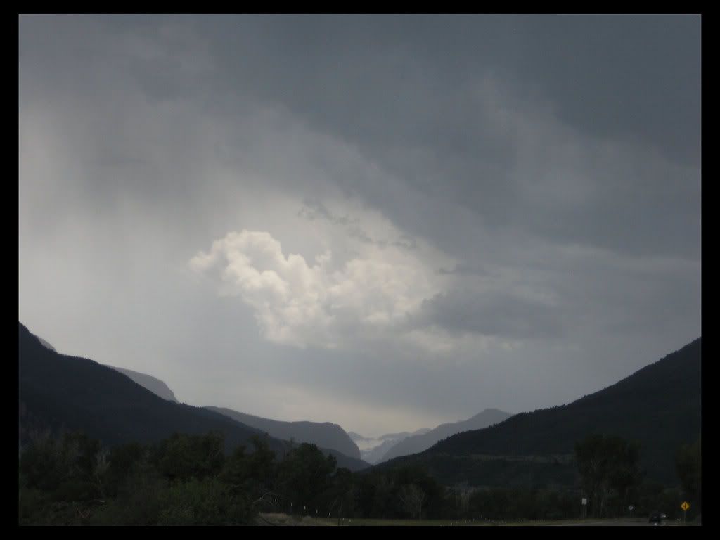
As it turned out I got pretty wet. The storm only dumped on me for about 10 miles or so, but it was a pretty hard rain. I had thought it was smaller then that, and did not put my rain gear on. Also I knew I had a ways to go for the day, and so I figured I would dry out fast anyways once the sun came back out, and that is exactly what happened. I always wear textile gear on these trips, and though my jacket is not waterproof, my pants are pretty good with the smaller storms. Here is a shot looking back at the storm from the other side.

Image

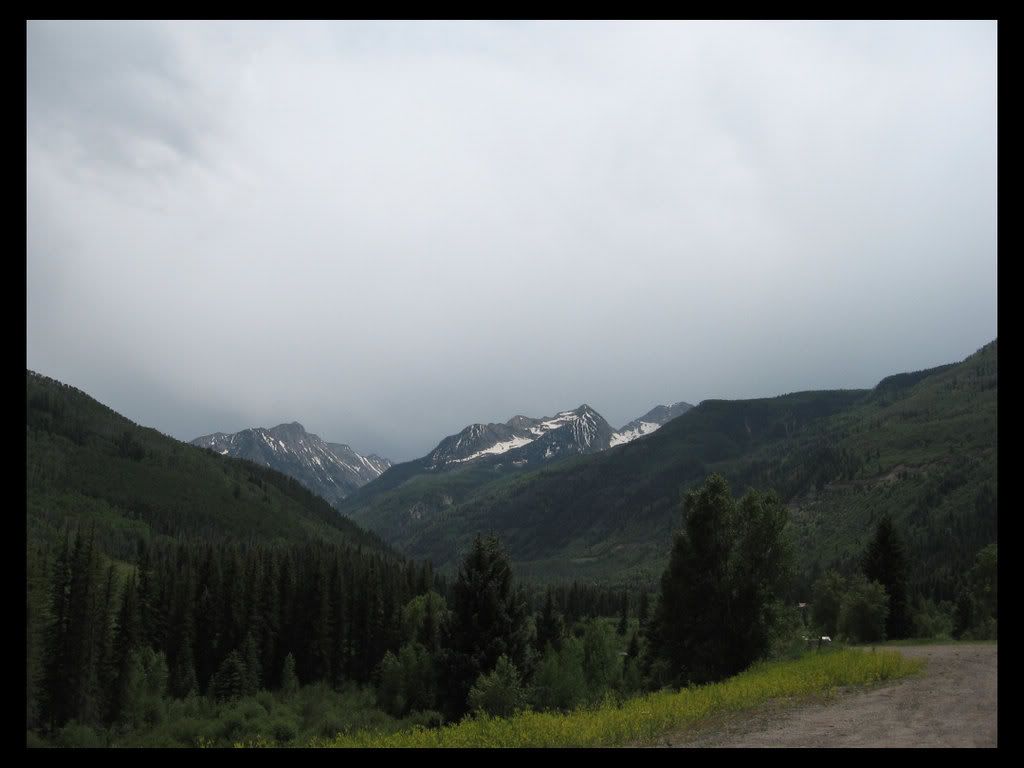
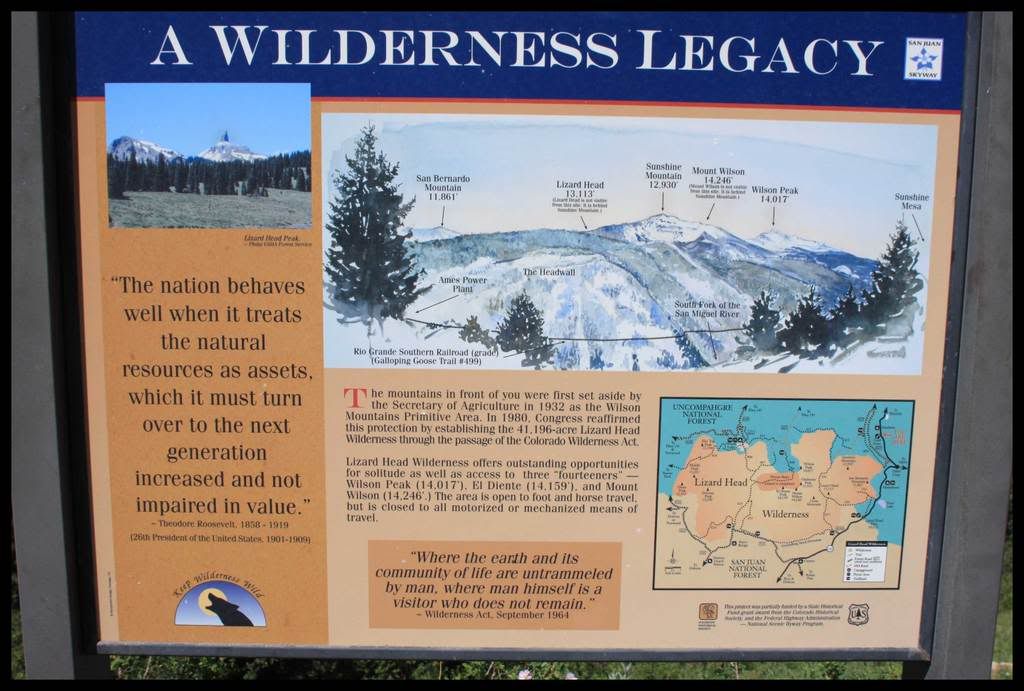
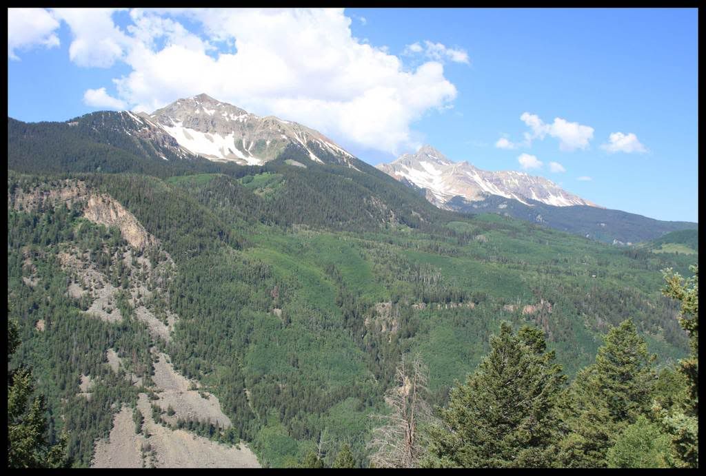
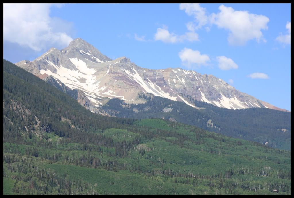
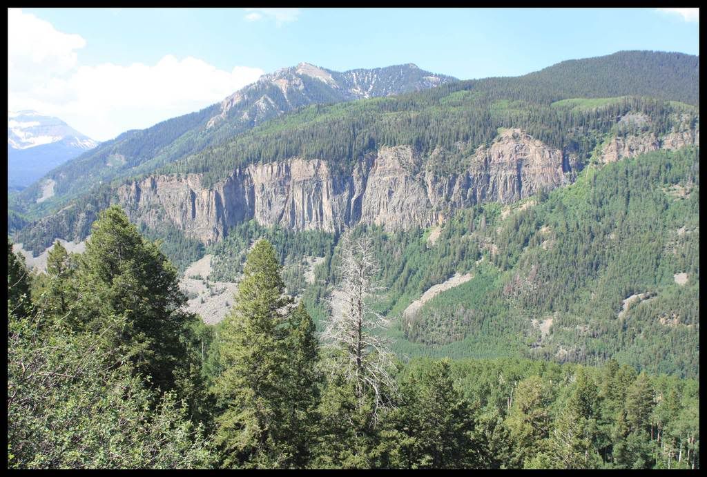
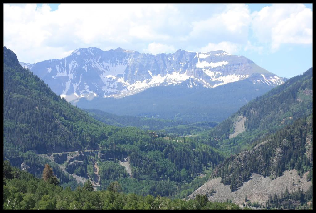
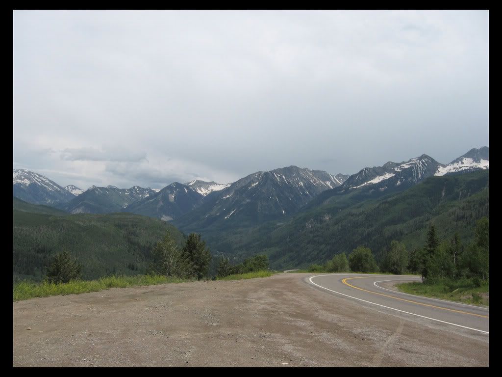
That shot and these next two are at the top of Wilkerson Pass, about 8500 ft., not too high for a Colorado mountain pass. The route between Carbondale and the pass follows the Crystal River. Nice name, and a really beautiful creek, it is quite fast, probably some superior fishing territory. I used to go camping there, but they don't allow it within ¼ of the banks anymore, and the canyon is only a couple of hundred feet wide most of the time. It also goes by the town of Redstone, a national historic district and home of the Redstone Castle. Google it.

Image

and the sun comes out and I begin to dry out.....

Image

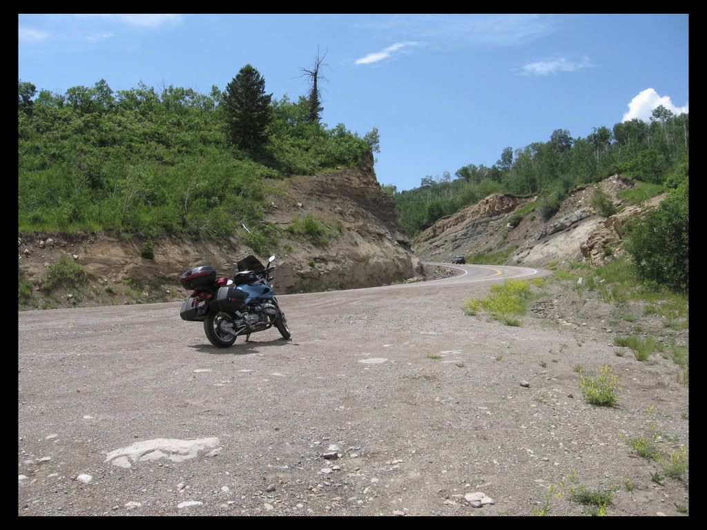
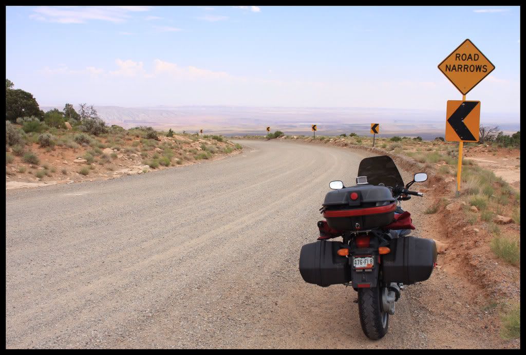
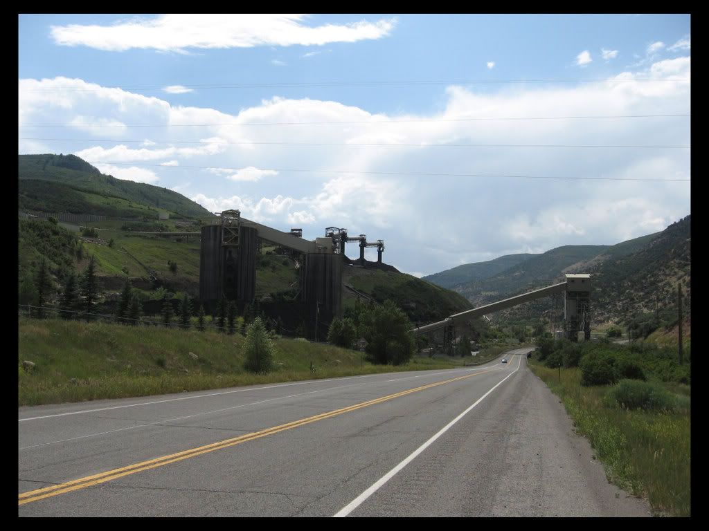
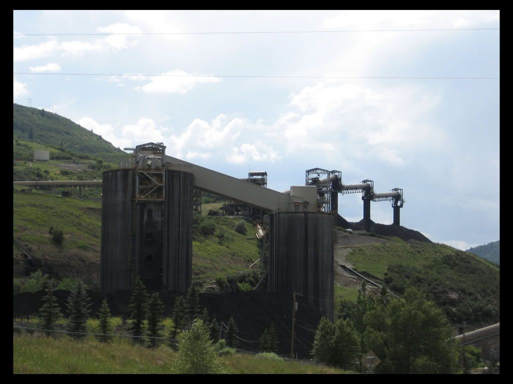
The pass is the beginning of a really beautiful 43 mile long ride through first, a stunningly beautiful aspen grove followed by an alpine meadow, and then a very twisty fun canyon, after which the canyon gradually widens a bit where the coal mines are located, in Somerset and then near Paonia.

The mine near Somerset. The coal mines of Colorado are underground. I can actually hear the trains that carry this stuff go by at night, all year long, on tracks that are about 4 miles south of my home. They have to whistle as they pass thru a town down there.
Image

Image

Image

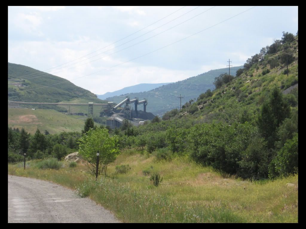
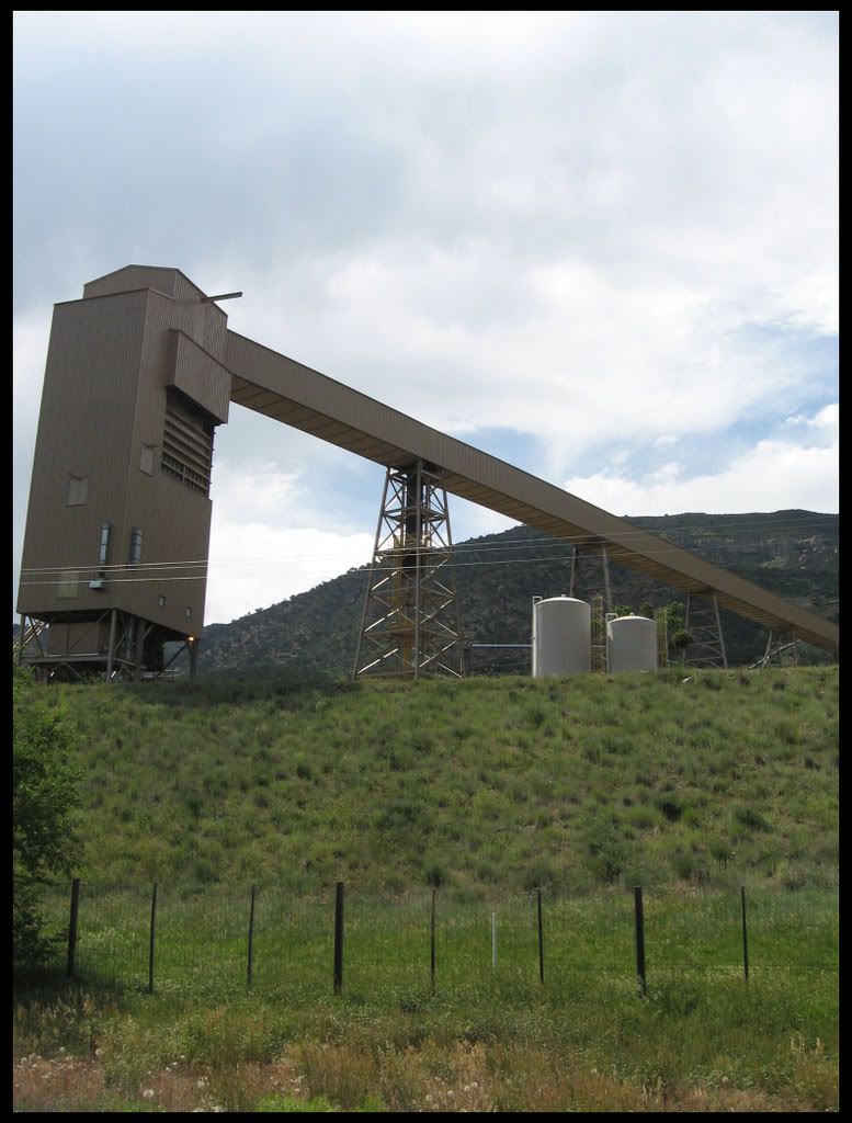
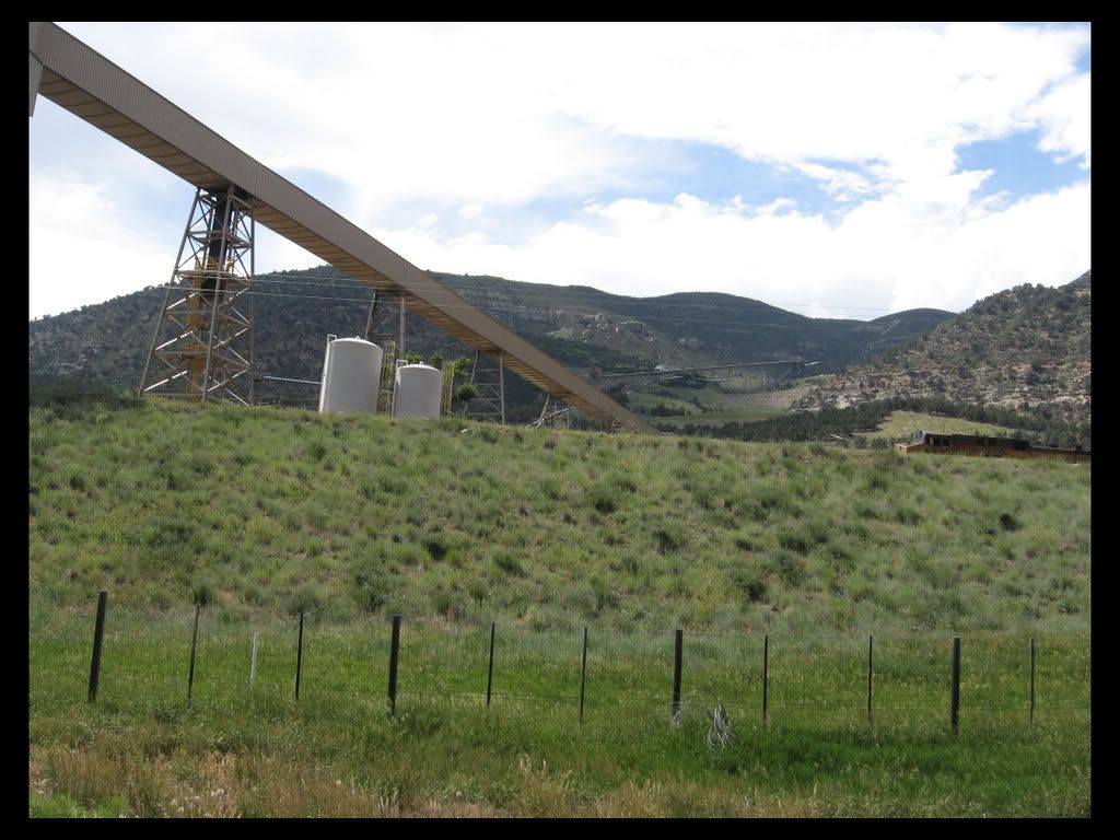
And the mine near Paonia.
Image

Image

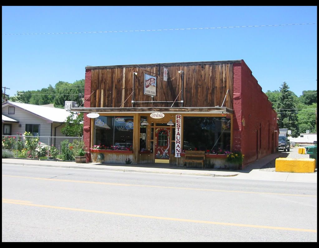
Highway 133 ends at Hotchkiss, an area of low lying and arid desert-like hills interspersed with fruit orchards. I got stopped for a while at a traffic construction site just outside of Hotchkiss about 5pm, so knowing I wasn't going to make it to where I had hoped to that day, I decided to just retire early.

Here is the place to eat in Hotchkiss, it's on Main street, which is the highway thru town, which is now CO92. It is mostly beef dishes on the menu. I tried some Mexican, always a gamble, but I was in the mood for some. It was passable, nothing to write home about. On other trips I have stopped in here for an ice cream break. The motel down the road was good, fairly new,and reasonable at $66 for a (almost) holiday weekend.

Image

End Day One
"none.nada.thank you."
mnnden
Basic User
Posts: 587
Joined: Thu Mar 17, 2005 6:22 pm
Donating Member #: 0
Location: MN

Re: Pacific Northwest via Monument Valley

Post by mnnden »

Toolinalong, Just great, the pictures are as good as they get, and the write-up is informative, I am really going to enjoy this, as for the numbering of the pictures (in regards to the location) I like it, if it isn't too much of an inconvenience I hope you continue to do it, either way, Thanks for taking the time to share, Keep them comming, Den
We all gave some,
Some gave all.

Anonymous
User avatar
1MPH
Lifer
Posts: 271
Joined: Sat Apr 23, 2005 3:06 pm
Donating Member #: 0
Location: Mill Valley, Calif..

Re: Pacific Northwest via Monument Valley

Post by 1MPH »

Very nice Toolin. I agree with Den. Looking forwards to rest of tale. :smt023
Jack
Mill Valley, California
2004 R1150R Piedmont Red
GypsyRR
Centurionette!
Posts: 1280
Joined: Sat Sep 23, 2006 11:13 pm
Donating Member #: 254
Location: Texas

Re: Pacific Northwest via Monument Valley

Post by GypsyRR »

GREAT!!!! I'm hitting the northern part of Colorado on my journey back to Texas next week. I've been wanting to ride 133 too - sort of out of the way for me, but maybe I'll come in from the west - or save it for another time. I look forward to the rest of the trip - while/when I have internet. Thanks for taking the time. I know - it does take a lot of time to write and process and upload and post a report. Looking forward to more.
Kristi
05 Granite Grey
toolinalong
Double Lifer
Posts: 166
Joined: Wed Apr 26, 2006 9:09 am
Donating Member #: 0
Location: COLORADO

Re: Pacific Northwest via Monument Valley

Post by toolinalong »

I hit the submit button too soon. see the next post below.
Moderator, please dump this one.
Last edited by toolinalong on Wed Jul 30, 2008 4:47 am, edited 1 time in total.
"none.nada.thank you."
toolinalong
Double Lifer
Posts: 166
Joined: Wed Apr 26, 2006 9:09 am
Donating Member #: 0
Location: COLORADO

Re: Pacific Northwest via Monument Valley

Post by toolinalong »

Thanks for the encouragement everyone. Here's another one.....

I stopped only 4 times to take pictures on this second day, and 3 of those times were late in the day. I left Hotchkiss at 7am, and arrived at Kayenta in Arizona at about 5:30pm, having picked up an hour in a time change. Ok, here is the map of Day 2:

Image

The ride down to Ridgeway on 550 isn't much. A lot of traffic for one thing. But from there on down to the Telluride turn off CO82 is a perfect mountain riding road. I often like to ride for a couple of hours or 100 miles before having breakfast. I stopped at a little place in Ridgeway about 9:30.

My first stop for pictures was at a pullout at what I call the "top" of Colorado Highway 145. Cause it is feels like it is mostly downhill to the town of Dolores from here, though in truth you have to go up and over Lizard Head Pass first, and the road itself goes up and down a lot. GypsyRR posted a whole slew of photos of this road coming from the other direction.

This little placard shows you what the pictures are looking at...

Image

A wide shot

Image

Wilson Peak medium shot

Image

Wilson Peak Closeup

Image

Sunshine Mountain Closeup

Image

The Headwall

Image

Looking south to where I am going, into the Lizard Head Wilderness Area and then down to the SW corner of the state.

Image

I always fill up the night before, when I go looking for dinner after checking into the motel. I filled up again in Dolores. I was about due, but also I was about to go on a road I had not used before to take me over to Utah. I did not know if I would find gas again before hitting Highway 191. As it turned out there were a couple of places before then. I averaged around 49 mpg on the trip when I wasn't trying to ride real fast.

I knew I wanted to try out a new (to me) road to get down to Mexican Hat, which is the start of Monument Valley. Pretty easy. It's called Highway 261. Go west on Utah 92 just south of Blanding. Stunning scenery and fabulous curvy, hilly country for about 50 miles. There was a small rainstorm in the area, but it kept just missing me, staying off to the south, though the road was wet once or twice where it had recently passed by. Then at the turn off onto 261 was this sign:

Image

That is my friend the rainstorm off to the left. For some reason I got a little freaked....out here this sign could mean a lot of things. Mostly it was because it was almost 3 in the afternoon, and I did not want to have to circle back to 191 and go down thru Bluff. About ten miles down the road was a ranger station. I stopped and asked, and they said motorcycles took it all the time. OK. Let's go see.

Here is where it turned to gravel.

Image

and here is what it looked like on the ZUMO

Image

The same rainstorm that I had been looking at for almost 75 miles now was still with me, but had taken on a really cool shape.

Image

I decided to park it and walk to the edge to see what I could see before starting down....

Image

This second pic is from the same vantage point but looking to the left.

Image

Standing here I couldn't see much of the road, but there was a motorcycle with a trailer parked about ¼ mile down at a turnout. I rode down and asked the rider, and he said he had been down it a lot, and it wasn't bad at all. He was right, it was nothing, one lane in the switchbacks was the only sort of tricky part.

At the bottom, looking back up...

Image

These folks had been parked at one of the lower switch backs, we exchanged of few pleasentries as I rode by at 10 mph.

Image

Once I was out in the valley about 5 miles I turned around to get a wide shot of where I had just been. You can see this little dimple on the landscape on the view from the top.

Image

Next stop, Goosenecks State Park.

Image

and

Image

That is the San Juan River which starts over in Colorado, and feeds into Lake Powell. I found this place back in 2001. It is not meant to be a camping spot, there's no water or tent sites or anything, just a couple of tables and an outhouse. I rode my R80/7 out a ways from the overlook and spent the night here. VERY quiet.

Image

Here are the panorama shots, left to right facing south to west:

Image

Image

Image

Image

And even though it looks like do-do, I show it to you anyways a really bad composite of the previous 4 shots:

Image

And the only picture of me the whole trip. The Frenchman did not speak English, but we took each other's pictures nonetheless.

Image

Ok, almost done. Just a few miles to Mexican Hat and then on into the Valley.

Here it is. 2 versions. I have always really liked this guy. Look real close for a minute. See what I mean?

Image

Image

The San Juan is a popular rafting trip. Slow, not much in the way of rapids, but lots of interesting terrain and some petroglyphs. I took it in a canoe once. It flows thru town, which is two blocks long and about a mile down the road from the rock. There is gas and a couple of motels and a decent eatery there.

I couldn't resist making another horrible panorama to show you what the river looks like here. Maybe some day I will buy one of those fancy fisheye thingys. Right.

Image

And I really like this one, hope you do to.

Image

See you tomorrow.
"none.nada.thank you."
toolinalong
Double Lifer
Posts: 166
Joined: Wed Apr 26, 2006 9:09 am
Donating Member #: 0
Location: COLORADO

Re: Pacific Northwest via Monument Valley

Post by toolinalong »

This trip was certainly one of the better ones for me, in terms of finding road after road of great riding. Lot's of mountains and forests, and lots of beautiful desert stuff, with a healthy dose of water features. For Day 3 I have just 3 sets of pictures, at the Glen Canyon Dam and Lake Powell overlooks, outside of Page, Arizona and a few shots from 2 different places on Highway 93 in Nevada.

Image

The ride began at 6am in Kayenta, AZ and ended up in Ely, Nevada around 5:30. It was in fact Friday July 4th, and so I choose Ely as my destination because I have stayed there many times and knew there were plenty of rooms available. As it turned out I had to stay at the most expensive place in town, the Ramada Inn (and Casino). Not worth the extra dollars, but when in Nevada it is a long distance between towns with motels.

Breakast was in Page, Arizona, a town created to house dam workers (I assume) and then to cater to the recreation needs of the Lake Powell area. On Friday July 4th it was full of RV's, SUV's pulling all sizes of watercraft, and harley's and sportbikes. (Which reminds me, on this trip I passed very few Beemer's on the road. Much less then I usually do.)

The basic facts: Built in 1956-66. 710 ft. high, 1560 ft. across at the top. 25 ft. wide at the top and 330 max. width at the bottom. Creates Lake Powell, which stretches north and east 186 miles into the sandstone desert. 400 feet deep, 2000 miles of shoreline. Houseboating mecca. The white area above the waterline shows the maximum level. The drought that began in the 1990's dropped the level, and it was quite a bit lower the last time I was here. It is rising again. Google Lake Powell for more info.

So here is a look at the dam and the small portion of the lake you can see that is near the dam:

Image

Image

Image

Image

Image

Image

Image

Image

Image

Image

A few miles north on US 89 is an overlook:

Here you can the dam from the other side, though it is quite far away

Image

And from here you can see the Waheap Marina, which is north and west of the dam a few miles

Image

This next picture starts a 3 picture panorama: the long shot of the dam above would be picture #4.

Image

Image

Image

Image

Here is a telephoto of the coal-fired "Navaho Generating Station" that is south of Page.The coal comes from the Peadbody Mine that is located near where I just came from,
on the Black Mesa near Kayenta, on Navaho Nation Reservation lands. I am guessing that is why it has that name.

Image

Here are a few closeups of the Waheap Marina complex and some boaters

Image

Image

Image

And the obligatory photo of the bike

Image


The day began and ended with windy conditions, the one thing I really dislike when riding. As I left Kayenta there was a 15-20 mph wind from the S, and I was traveling SW and W, so it was a crosswind. I believe that the 3 or 4 times I have ridden that stretch of Highway 160 there has always been some wind. But I knew I only had about 50 miles to go before turning north for Page, so mentally I dealt with it that way, knowing that soon it would be at my back. The crossing over into Nevada from Cedar City on highway 52 later in the day was also a crosswind situation, still from the south as I was travelling west. This time there were open stretches, and those low hills that tend to accelerate the wind, but there was a fair mount of the crossing that was in the timber. After 100 miles I was again headed north on US 93, and it was again at my back. As the road hugged the mountain range on the west side of the valley, there were some gusts that took me from the side from time to time, as the wind would bounce off the hills and funnnel down. The few bikers I passed who were heading south to Las Vegas were obviously struggling with it. It was probably a sustained 15-20 mph with a few gusts to maybe 30 most of the afternoon. Also FYI, there is now a nice new Shell station at Panaca. In 2001, on my R80/7, I went from St. George, UT to Ely, a distance a bit over 200 miles, and there were no gas stations.

This picnic table is one I have visited before. The last time here I shared it with a long haul trucker and his wife, who were on there way up to Boise. It's one of the very very, few rest stops located on those long stretches of Nevada highway. No toilet facilities or water.

Image

Image

These shots create another panorama that begins north and pans east to south. By the way, in case you haven't figured it out yet by looking at the map, this is one of those roads you can use to see how fast your bike will go. Long, long straights.

Image
Image
Image
Image
Image

On the map this road seems to run up to the hills and then heads north along the east side of the valley.
Image


At the north end of the valley is located Great Basin National Park. This photo looks east towards the western side of it.

Image

It's highest peak is this one, Wheeler Peak, at 13063 ft. About 2 weeks ago I came thru this area, heading home on US 50 after a trip to the southwest and there was still a fair amount of snow on the peak.

Image

Everywhere I went in Nevada was hazy. I thought it might be because of the California fires, and later in the NW part of the state it was, but a local told me over here in the east it was because of the wind, which had been blowing for several days. It was still blowing when I stopped to take these around 5pm, and it was blowing all the way to Ely.


End of Day Three
"none.nada.thank you."
User avatar
sweatmark
Septuple Lifer
Posts: 2236
Joined: Mon Mar 21, 2005 11:11 am
Donating Member #: 208
Location: Oregon USA

Re: Pacific Northwest via Monument Valley

Post by sweatmark »

Good stuff. Can't wait to see what you saw up here in the Pacific Nortwest, certainly a change from the scenery shown above.

I've been meaning to ride across Nevada on 50, just because it's needs to be done. Does it need to be done?
User avatar
bmwdave52
Lifer
Posts: 291
Joined: Sun Mar 20, 2005 1:41 am
Donating Member #: 0
Location: Sacramento CA

Re: Pacific Northwest via Monument Valley

Post by bmwdave52 »

Pioche NV has a Chevron station up on the hill in town.
If you are taking US50 across Nevada consider exploring RT722 at Austin NV (going west a mile out of town). It dumps you back on 50 at the 'shoe tree' about 60 miles later. There is one mile difference in the distance traveled between 50 and 722. However there is a WORLD of difference in the scenery. Very different than 50.
"When life throws you a curve lean into it"
Proud member since 2001; #17(Life)
toolinalong
Double Lifer
Posts: 166
Joined: Wed Apr 26, 2006 9:09 am
Donating Member #: 0
Location: COLORADO

Re: Pacific Northwest via Monument Valley

Post by toolinalong »

Ok yea I see what you mean about that 722 road, I'll definitely try it next time.

Well I just did a stretch of I-80 which you will see on the next post's map. It's awfully beautiful territory up there, but it is slab riding. I actually like US 50. It is a series of mountain ranges that run north-south, wIth 25- 35 mile wide valleys in between. So one is always looking at the next mountain range and wondering what the road thru it will be like. The only part I don't care for is the stretch east of the first mountain range over in Utah, the last 50 miles or so before getting to Delta. I could do without that. Also, I prefer doing it west to east, but either way you have some nice territory at the end, either in Utah or the Sierra Nevadas, thus it is not like the midwest where when you finish 400 miles of Iowa, you get to do 400 miles of Kansas or Nebraska. So sort of long yes, but not much traffic. It can be done in about 6 hours with a pit stop in the middle. It's not that bad. It is about 320 miles from Carson City to Ely. Another 150 miles to Delta Utah, with not that much in between to look at, I have always stopped in Ely.

Here's a pic of what I'm talking about.

Image
"none.nada.thank you."
DSKYZD
Lifer
Posts: 1182
Joined: Thu Mar 17, 2005 8:42 pm
Donating Member #: 187
Location: Bluefield, VA

Re: Pacific Northwest via Monument Valley

Post by DSKYZD »

Lots of great pictures there.

I dig the panoramas!!
JOURNEY JUNKIE #187
toolinalong
Double Lifer
Posts: 166
Joined: Wed Apr 26, 2006 9:09 am
Donating Member #: 0
Location: COLORADO

Re: Pacific Northwest via Monument Valley

Post by toolinalong »

OK, got a few more here. (been kinda busy lately, I teach, and school started this week, been getting stuff ready for that)

day 4 547 miles 7am to 4:30 pm

ely, nevada to lakeview, oregon

map:
http://maps.google.com/maps?f=d&saddr=e ... 915894&z=8

pictures taken just south of Wells, Nevada approx. 9:30 am (location B)

looking south
Image

looking west
Image

looking north, the White Mountains
Image

a hawk?, there were two circling overhead.....
Image


next photo op, at the junction of US95 & Nevada 140 (location D):

looking south
Image

looking east
Image

suddenly, walking up out of a small draw just north of the junction comes a man named Joey Force. says he is a poet.
he asked me where I was headed. after jawing for a bit, he asked for some water. I poured half a bottle of water (I carry 2-32oz bottles, but one was already empty) into his 1 gallon coleman water jug.
then, upon questioning, he said he had been waiting there, trying to get a ride, for a week. this junction is 40 some miles north of winnemucca, and there are no other towns along the way.
ok, so now it's time to go. I asked him if I could take his picture. he said yes, and could I send it to him at his home. I said yes, and he wrote down an address in Oregon.

joey pic
Image

now comes the weird part. later in the day it hit me. I realized that I had run into this same guy back in 1990, on a trip up the coast and on to seattle. it was in oregon. where he lives. no poo. same scenario, he asked that I send the picture. that is why I remember him. same address in oregon. dig it. if the pattern repeats, something big is about to change in my life. that's what happened last time. hee, hee.

ok. moving on here.
fyi, gas is available at a little crossroads tavern/gas pump at Denio Junction (location E), the only gas stop I saw between Winnemucca and Lakeview, a distance that Google says is 211 miles.

photos: 30 miles or so west of location E

Image

Image

Image


photos: location F

Image

Image

Image


end day 4


*************************************************************************

day 5 286 miles 7am to 5pm

lakeview, oregon to oakridge, oregon via crater lake national park

map:
http://maps.google.com/maps?f=d&saddr=l ... F8&t=h&z=9

all photos this day are either

10 or so miles away at location C:

Image

Image

Image

the distant peaks are the rim of the caldara of the volcano that blew away....it was about 12000 ft high before the explosion, and the highest peak on Rim drive is 8151 ft, so about 4000 ft disappeared in the explosion.

Image

or at crater lake:

location D, at the "rim village" overlook; looking north, and in sequence left (west) to right (east). the lake is 6 miles across at it's widest.

Image

Image

Image

Image

and loaded for bear:

Image

Image


location E, wizard island overlook....

Image

Image

Image

Image

Image

Image

you can take a boat trip across the lake....

Image

Image

Image

Image


location F, on the north side looking around....

Image

Image

Image

Image

Image

Image


so that's crater lake. this was my 2nd trip to this incredible natural wonder. highly recommended.

and did I mention how much I love that Canon D40? these pics are all without any photoshoppin' except to resize and add the borders.

Image


end of day 5.
"none.nada.thank you."
User avatar
jas
Double Lifer
Posts: 354
Joined: Mon May 15, 2006 8:54 pm
Donating Member #: 0
Location: Eagle, ID

Re: Pacific Northwest via Monument Valley

Post by jas »

Very nice pictures. FYI, I have met your Denio friend "Joey" on many occasions. I was raised in Lakeview, OR and have worked for the NPS at Crater Lake NP.
2004 Roc.
fj_pastor
Basic User
Posts: 79
Joined: Sun Jan 21, 2007 4:24 pm

Re: Pacific Northwest via Monument Valley

Post by fj_pastor »

Many thanks. Very nice pics, description .... feels we are with you.
Try to make a book for yourself to keep ( I use Blurb and the quality is magnificent )

Best regards

Javier
Airman
Basic User
Posts: 1109
Joined: Thu Mar 17, 2005 11:47 pm
Donating Member #: 0
Location: South of Seattle

Re: Pacific Northwest via Monument Valley

Post by Airman »

Excellent pictures.
In that last one you have a good shot of your touring rig. Can you tell us more about your setup? I have the K12RS mirrors and Wonderlich touring bars, which are working well, but I'm not happy with the BMW touring screen. I see you have a nice wide tinted screen. Cee Bailey's ?
I don't get caught in the rain, I ride in it on purpose.
Post Reply